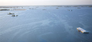
After record-breaking searing drought last year, farmers and ranchers are up against the wettest spring ever, one of the many indications of the increasing volatility associated with climate change.
Corn planting, for example has been delayed this because of heavy rain and flooding from the northern Midwest to as far south as Tennessee. Last year, the drought reduced production to a
six-year low.

Farmers and ranchers need resources and research to make better choices on planting and dealing with threats from the weather, says Agriculture Secretary Tom Vilsack.
You’re going to see a lot more stress on crops and livestock from climate change, he told Bloomberg. "You’re going to see crops produced in one area no longer able to be produced, unless we mitigate and adapt now."
To help them cope and to mitigate emissions that are causing the problem in the first place, the US Department of Agriculture (USDA) is taking an interesting approach.
The USDA is establishing seven "Regional Climate Hubs": Northeast, Midwest, Southeast, Northern Plains, Southern Plains, Pacific Northwest, and Southwest.
Disaster relief will be based on the region and how farmers/ranchers are adapting to climate volatility. Each region will have its own climate mitigation plan, based on USDA calculations of carbon emissions associated with farming practices.
The idea is to help farmers understand how to boost soil quality and limit greenhouse gas emissions by improving the soil so that it sequesters carbon rather than contributing to carbon emissions. Tools include planting cover crops, which are standard in organic agriculture.
Conservation methods will also be customized for each region. A "Carbon Management and Evaluation Tool" (COMET-FARM) will help producers calculate how much carbon their conservation actions can remove from the atmosphere and how their land management decisions impact energy use and carbon emissions.
Producers enter information about their land online – including location, soil characteristics, tillage and nutrient use. The tool then estimates carbon sequestration and greenhouse gas emission reductions associated with conservation practices for cropland, pasture, rangeland, livestock operations and energy.
USDA has also created a database based on its Rapid Carbon Assessment, which developed statistically reliable quantitative estimates of amounts and distribution of carbon stocks for US soils under various land covers and, to the extent possible, differing agricultural management. Over the course of three years, they collected 145,000 samples from 6,000 randomly selected locations.
Average temperatures in the most important growing regions in the US are expected to rise more than the rest of the country – as much as 4-6 degrees Fahrenheit over the next 40 years, according to USDA figures.
In April, the USDA signed an agreement with the dairy industry to develop a roadmap for significant adoption of biogas, a crucial technology for reducing emissions, providing clean energy to farmers and a new revenue source.
Another wonderful program is USDA’s Farm to Schools, which connects school cafeterias with local farms.
Read our article, Re-Naturalizing the US: A New Goal, Thanks to Climate Change – the solution to both increased flooding and severe drought is to "re-naturalize" the hydrology of a large section of the US.
